Illustrated Map for Huntingdon First
An illustrated map created for Huntingdon First to show the town’s sites and popular attractions as well as restaurants and cafes. The map will help people to navigate the town as well as advertise spots that people may not have known about when visiting.

Map of Huntingdon, illustrated using watercolour, gouache, ink and pencil before being put built digitally.
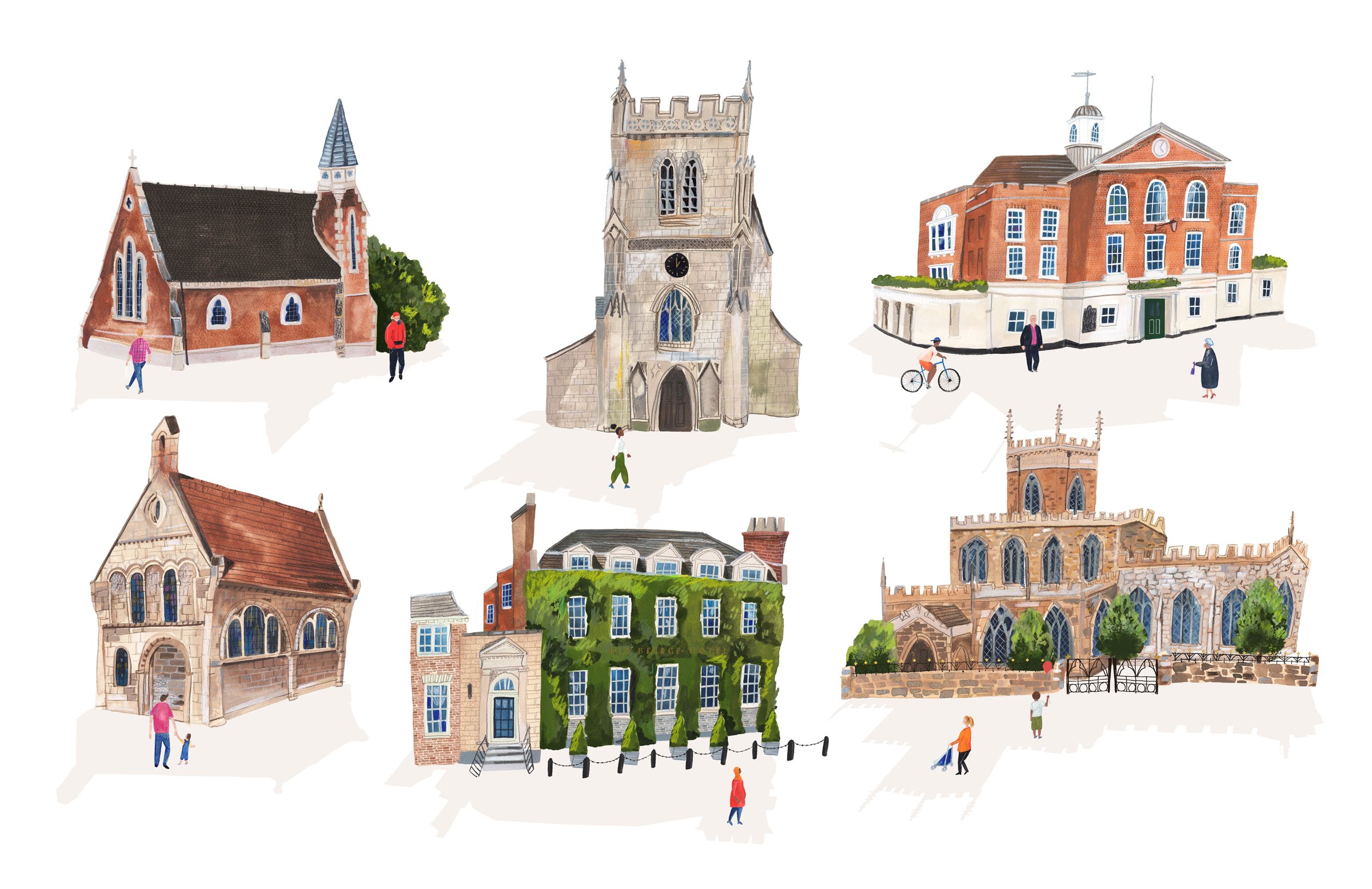
Hand illustrated assets for map of Huntingdon, created with watercolour, gouache and ink before being edited digitally.

Illustrated map of Huntingdon as leaflet

Hand illustrated asset for Huntingdon Map

Illustrated map of Huntingdon, shown with the key in the brand colours for Huntingdon First
All elements were drawn by hand using watercolour, gouache and ink before being digitalised so that the map can be used for a variety of purposes and sizes. The colour palette of the key was taken from the branding created by AVIDD for Huntingdon First to tie in with the rest of the visual identity of the town. This hand illustrated map will be used as a map within the town, on handouts and also with individual illustrations being used for designs on homeware and gift items within the town.
For more information on Huntingdon First or the Design Agency Avidd, please use the links below: